
Work resumed at full pace In 1874, when the high trestle over the Le Sueur River bridge was built. The line continued through towns such as Mapleton. After going through a couple more towns, it ended up at the Milwaukee Road at Wells. It could access Albert Lea, Austin and other places too. It eventually did become part of the Milwaukee Road in 1880.
After the Milwaukee Road takeover, it was reduced to a branch line. It did connect to the line from Mankato to Farmington. Milwaukee Road operated over this line for almost 100 year s, before it finally abandoned a portion from Minnesota Lake, near wells to Mankato. The part from Wells to Minnesota Lake is still used.
The tracks were ripped out, but for some reason, the bridges never were. Soon after the
abandonment, a group of citizens proposed the development of a trail from Mankato to
Rapidan, just south of Mankato.
But controversy followed. Proponents cited the scenic valley, preservation of the historic
high trestle, danger to bikers and pedestrians along TH66, and conservation values.
Opponents cited danger to users, loss of farmland, and loss of privacy to adjacent
landowners. Local newspapers got in on the debate, and opponents began a petition to put
an end to trail talks. Both the county and the DNR lost interest in the project.
But people weren�t ready to give up. A private group within the city purchased the center
30 feet of the railroad for a couple miles. A trail was developed from West High School
to the south end of town.
By 1991, the Red Jacket Trail Task Force which was organized by a group of citizens
approaches Blue Earth County and asked for money and permission to develop all the way to
Rapidan. 24 land owners agreed. About 1/3 gave up the land, another 1/3 sold it, and the
last bit the county had to just take their land.
Finally, the trail was built by the task force. They almost instantly turned it over to
the County. This trail is a rare example of the county, state, city and citizens all
working together.
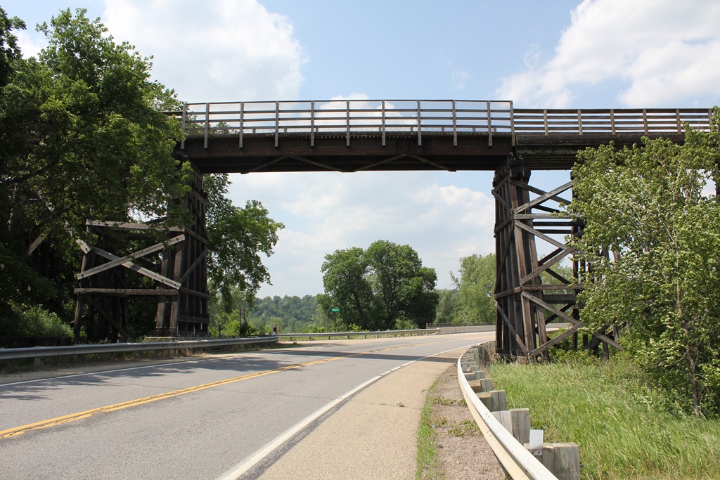
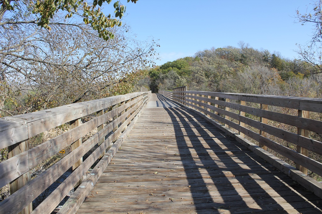
This trail starts in suburban backyards, goes up into the bluffs, crosses high above the
Le Sueur River, then goes into the woods and eventually crosses through farm fields.
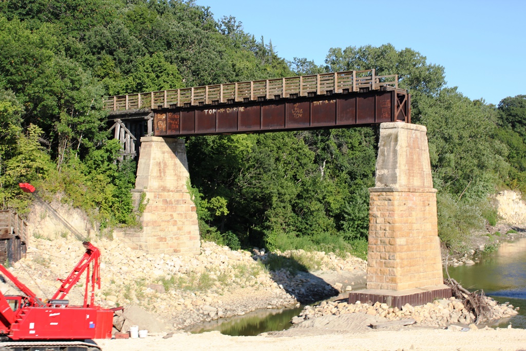
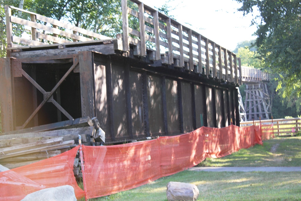
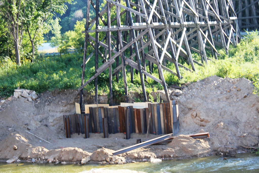
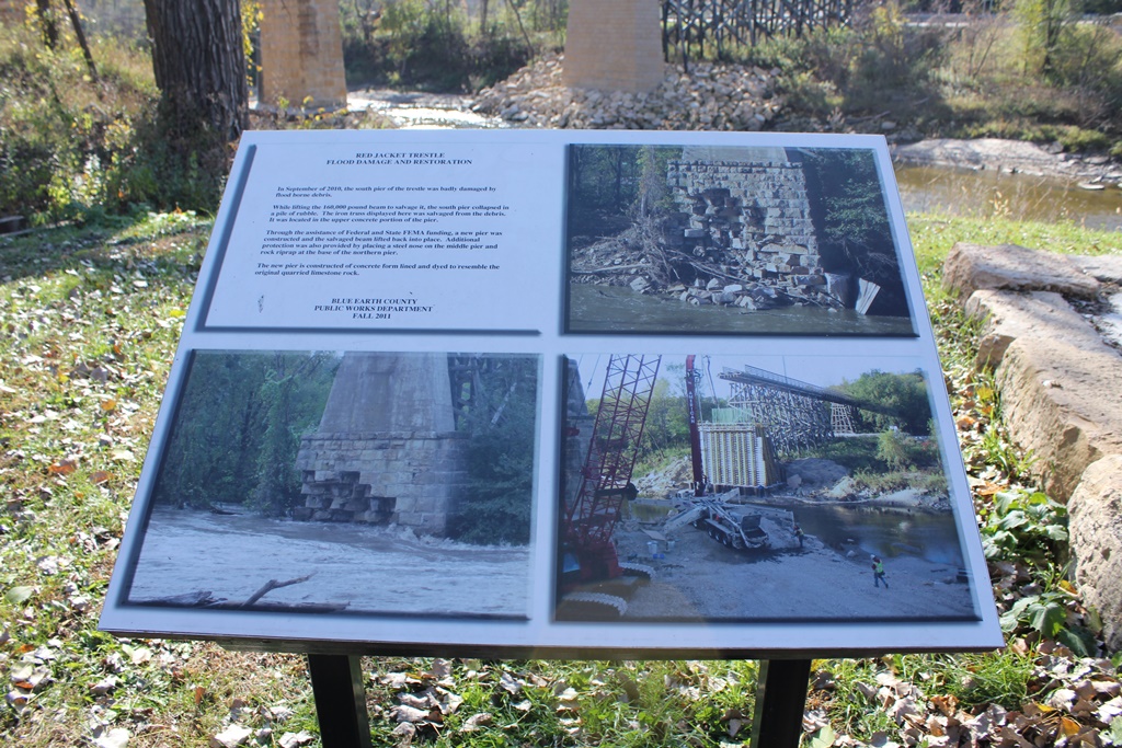
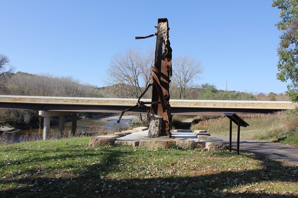
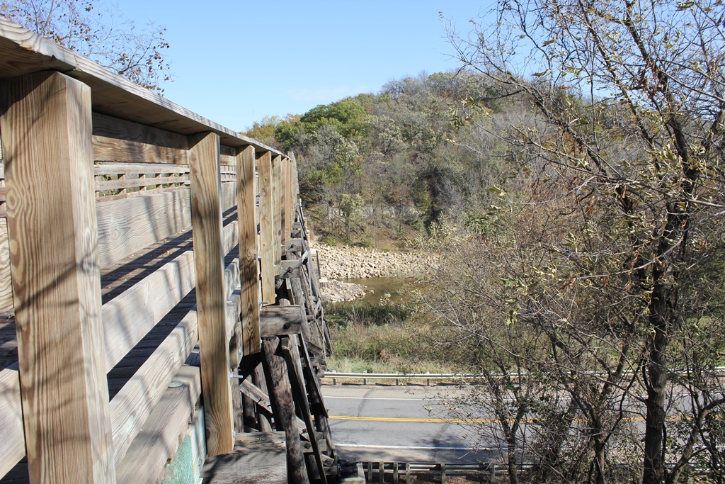
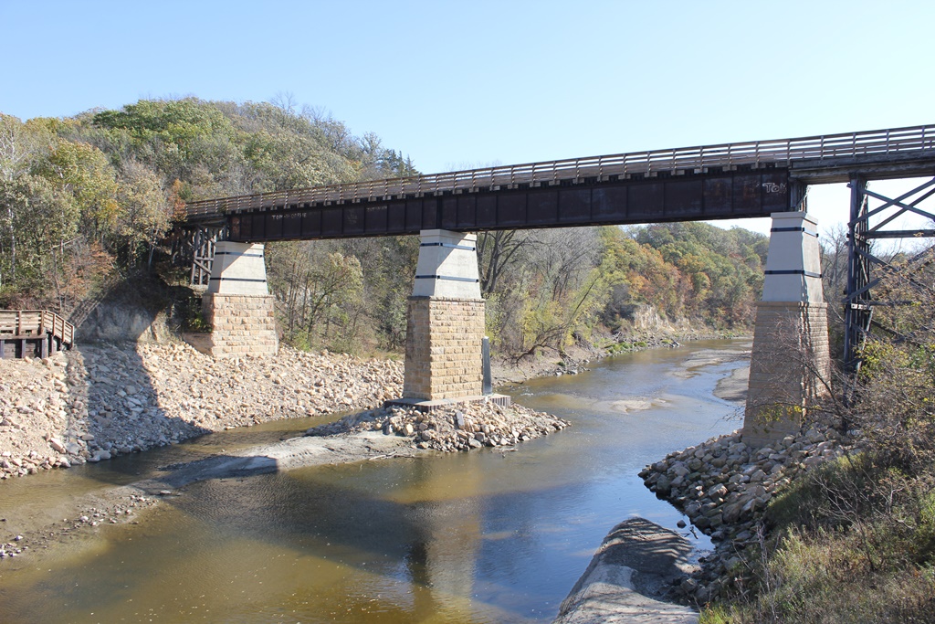
Disaster struck the Le Sueur River bridge, nicknamed the Red Jacket Trestle in fall 2010
after record flooding. Part of the stone base on Pier #3 collapsed, and there was debate
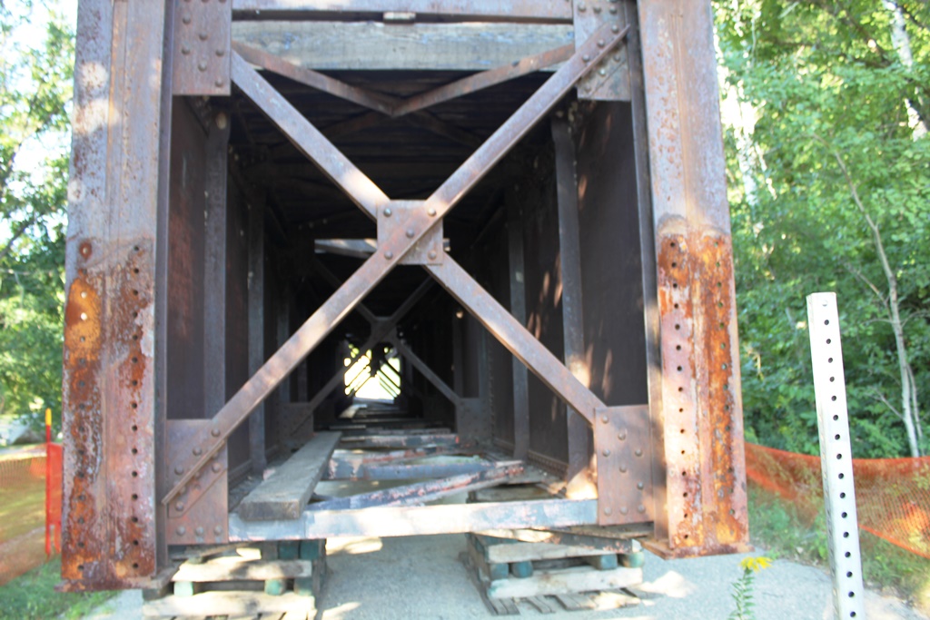
over what to do with the bridge. It was decided to pull Span #2 off the pier, and repair
it. But when the span came off, the pier collapsed. The span was put on the ground in
Red Jacket Park, next to the bridge. A replica pier was built out of concrete, the span
was put back in place, and it reopened in November 2011.
12/03/21
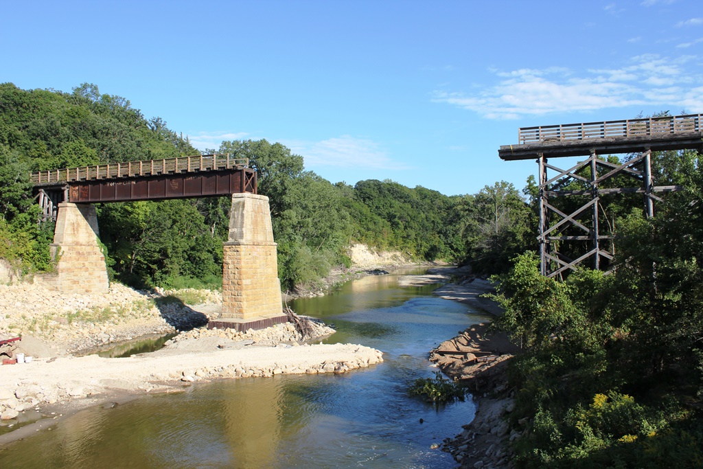
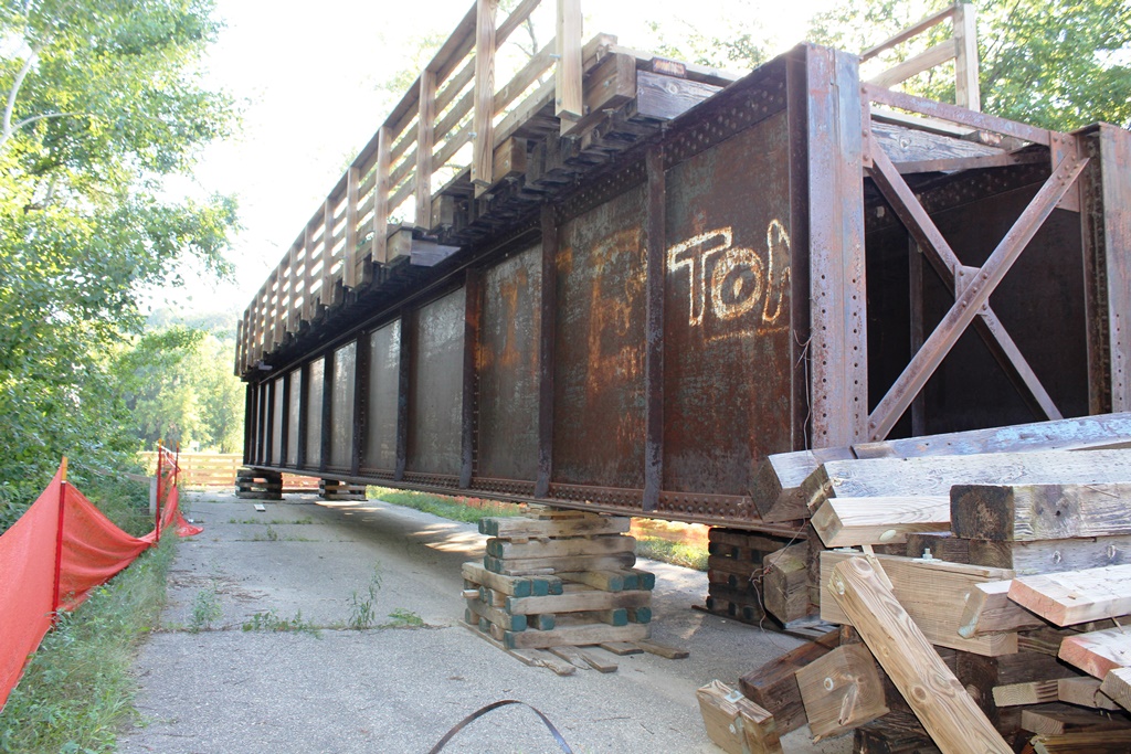
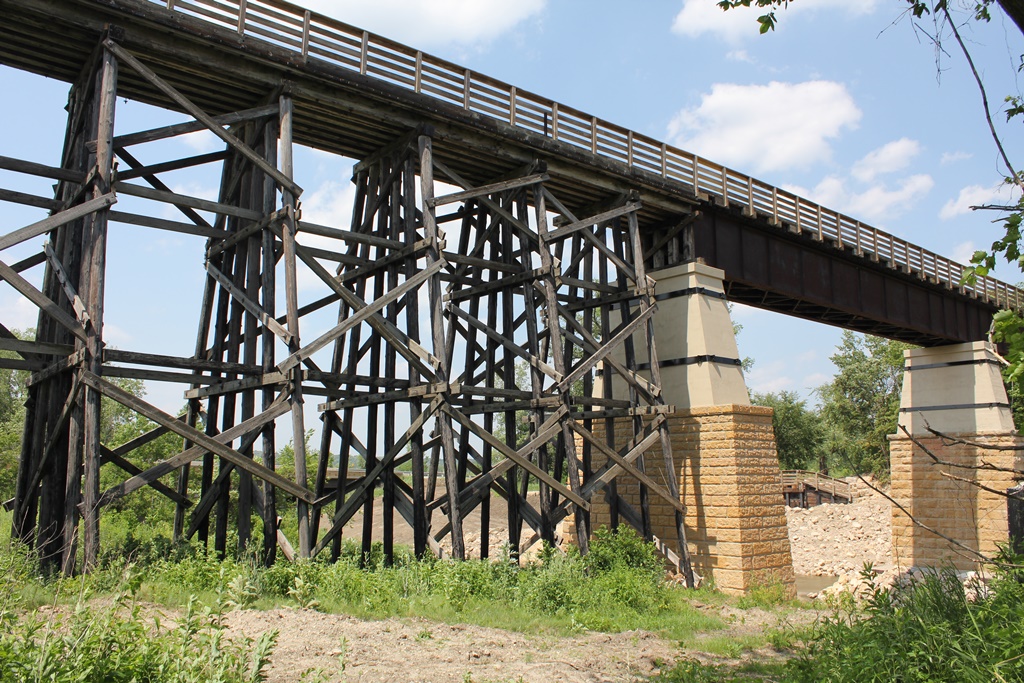
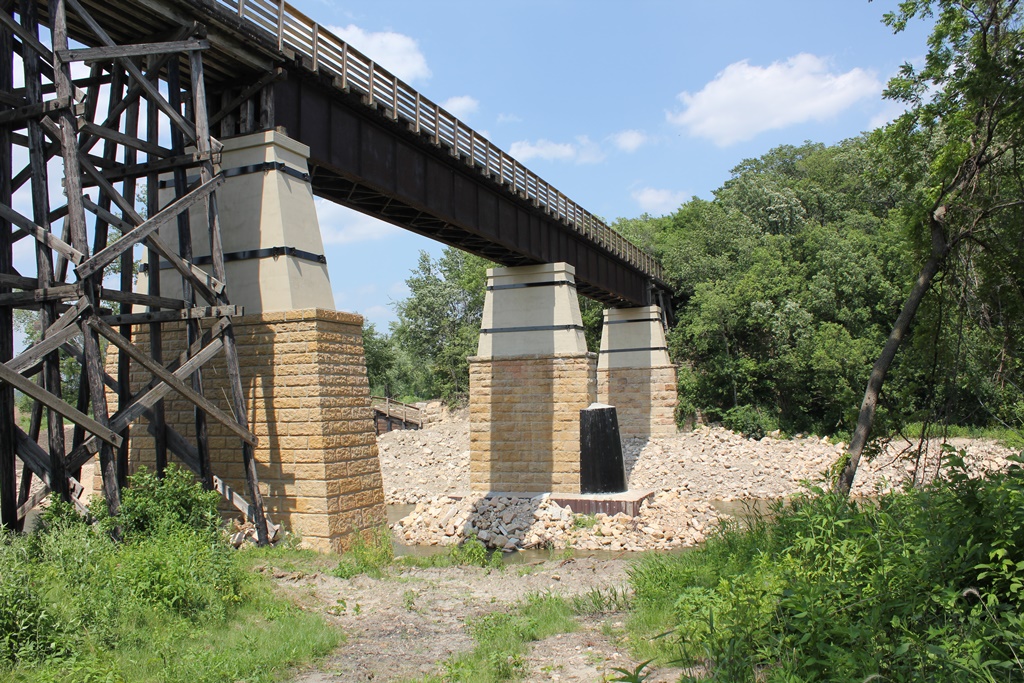
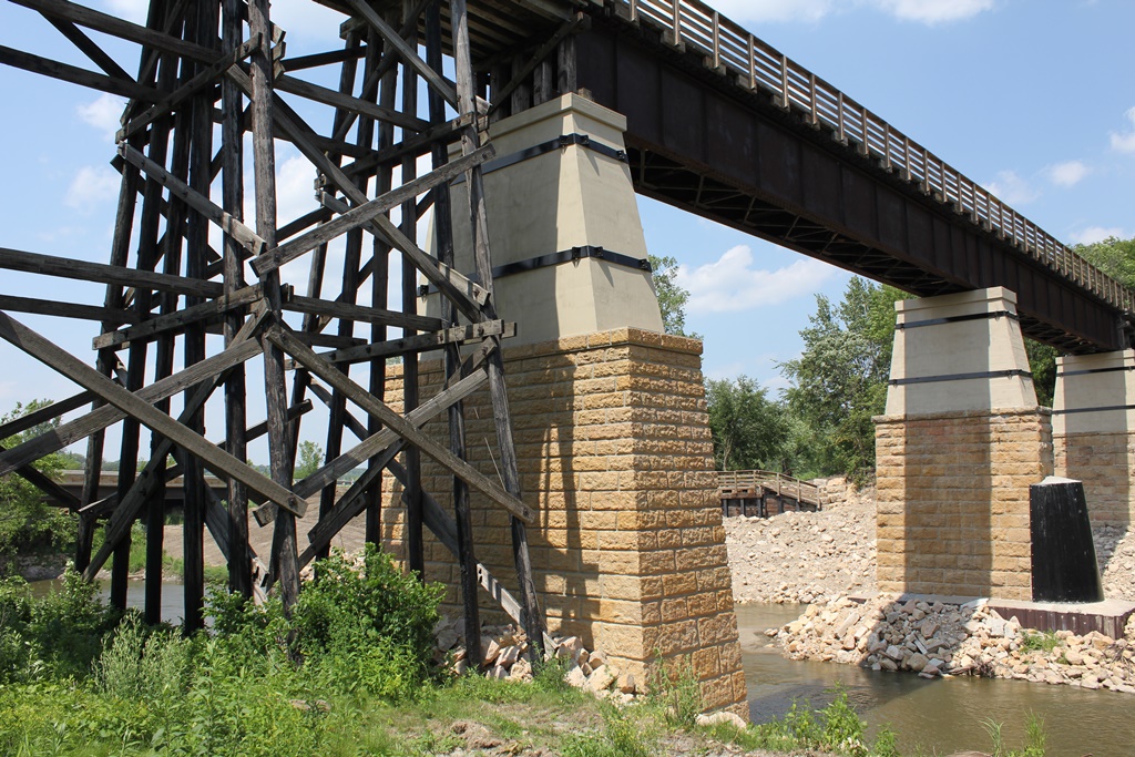
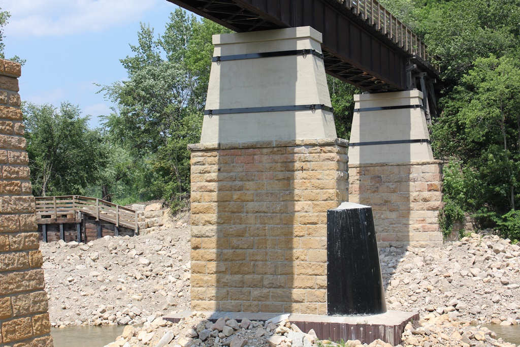
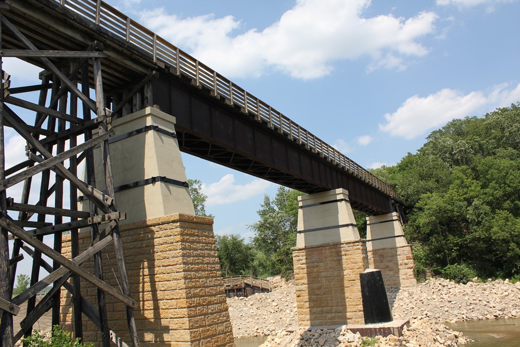
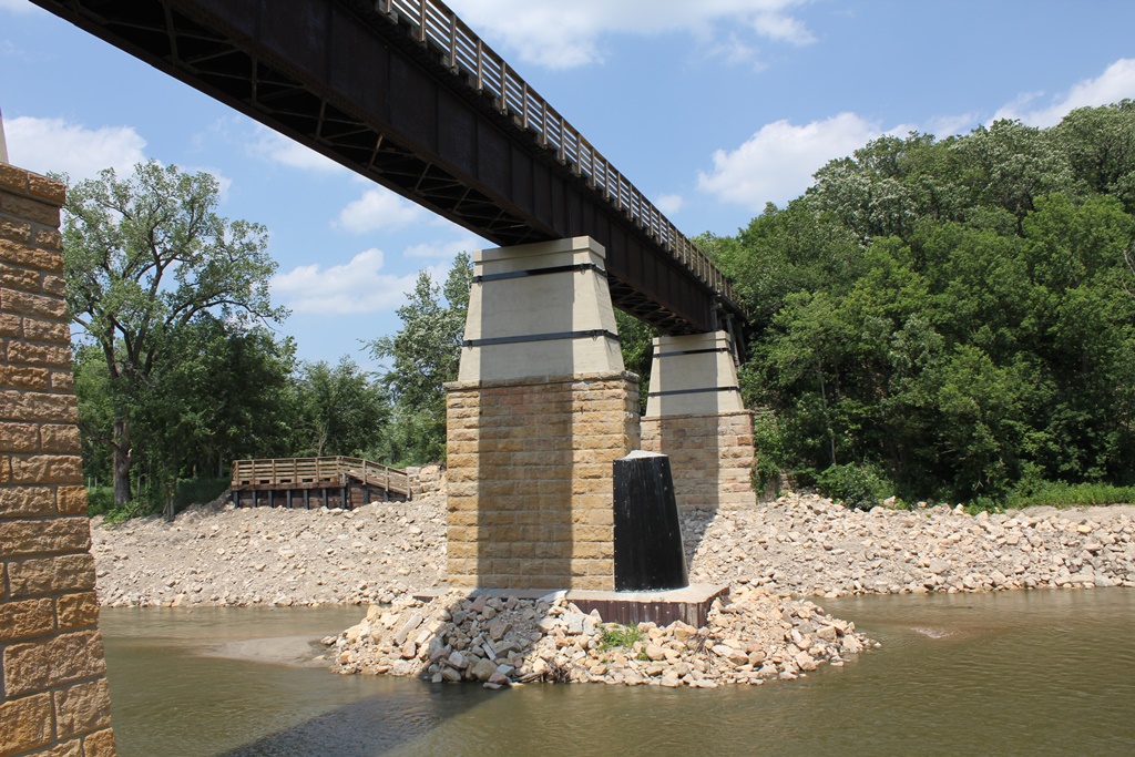
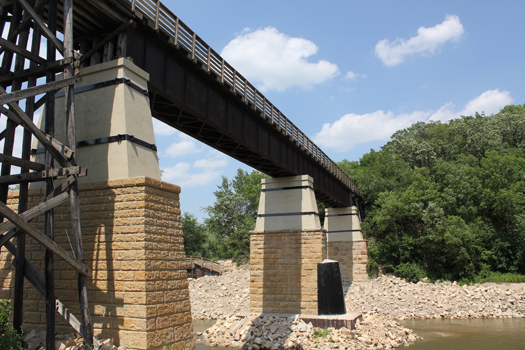
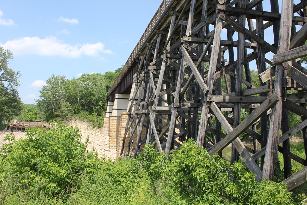
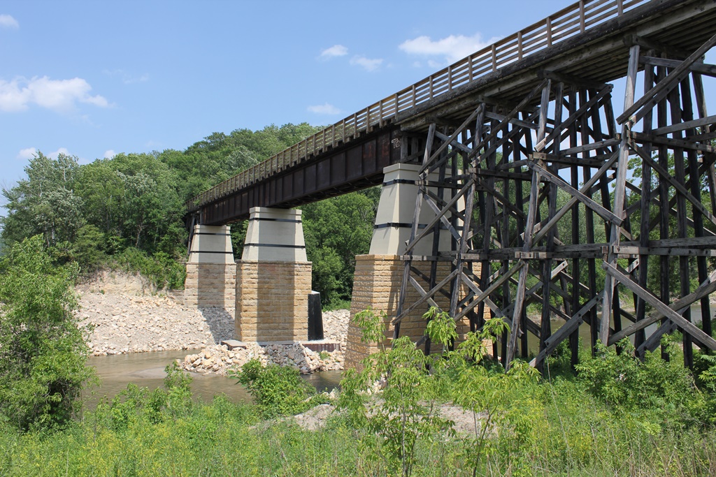
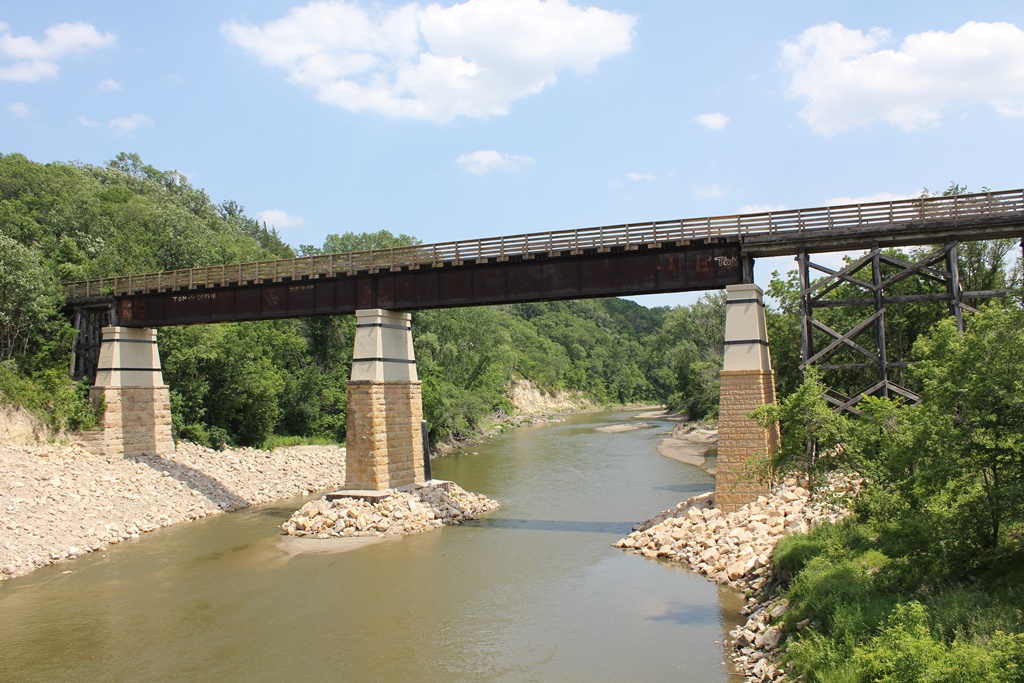
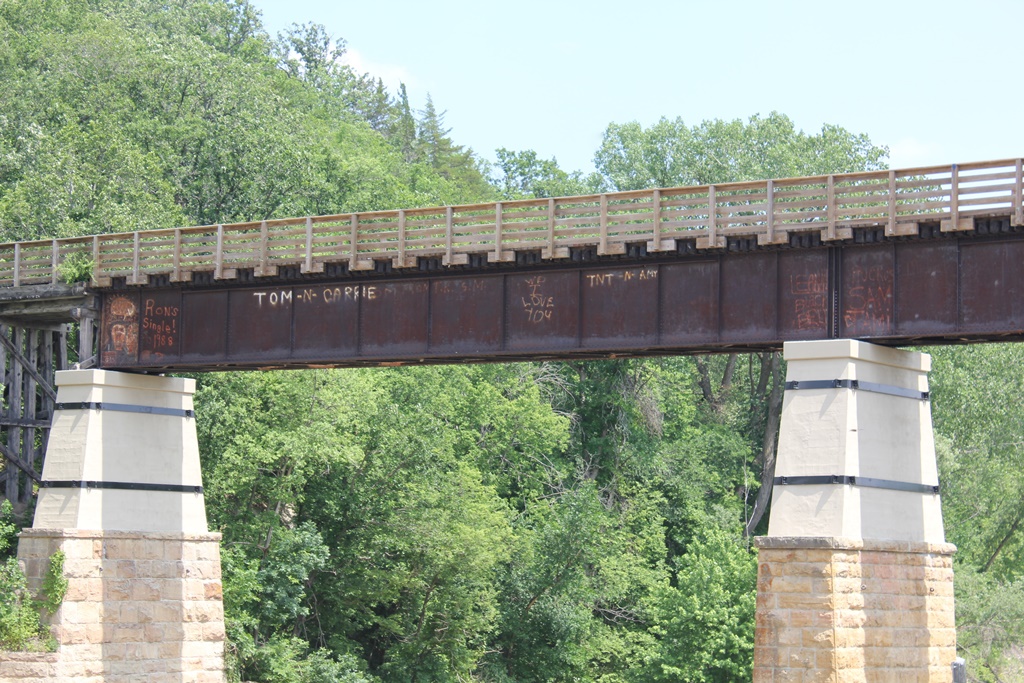
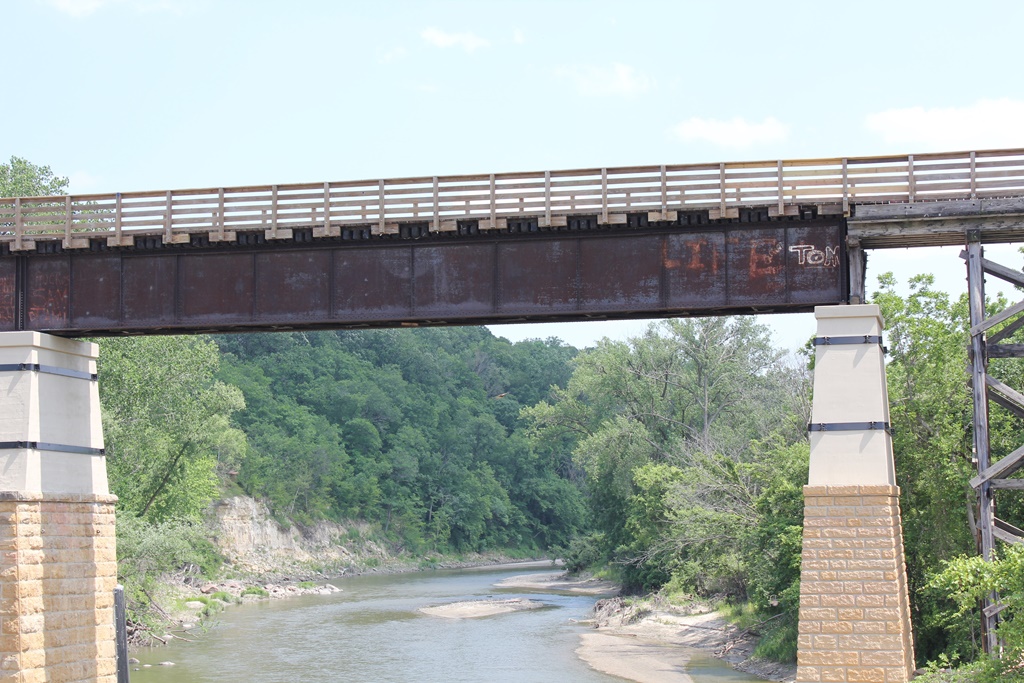
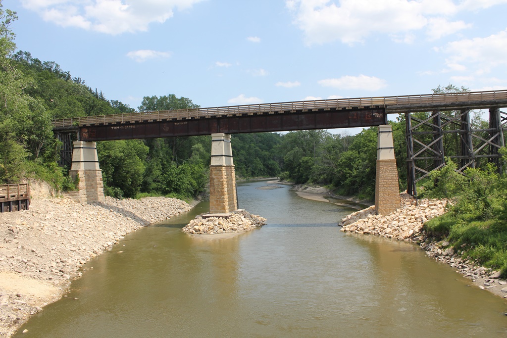
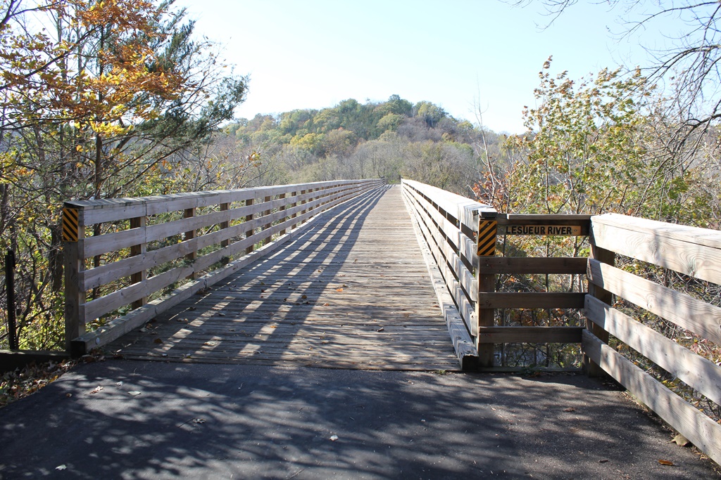
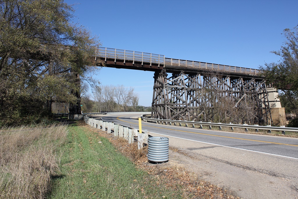
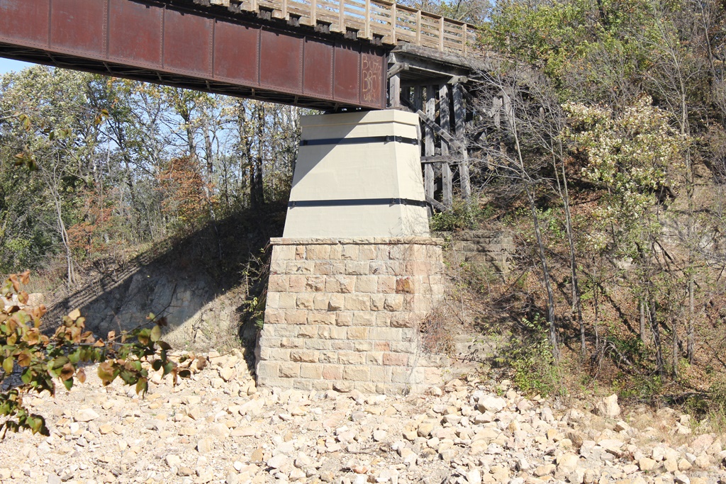
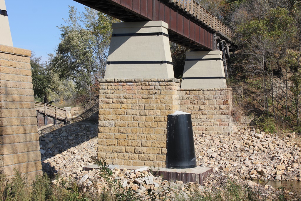
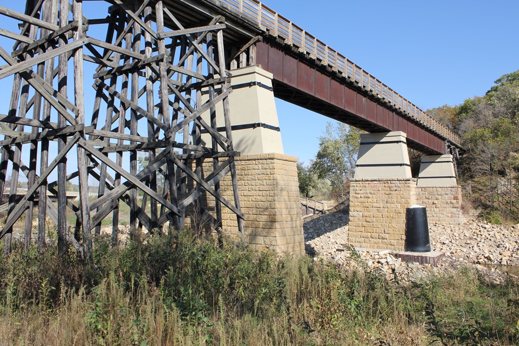
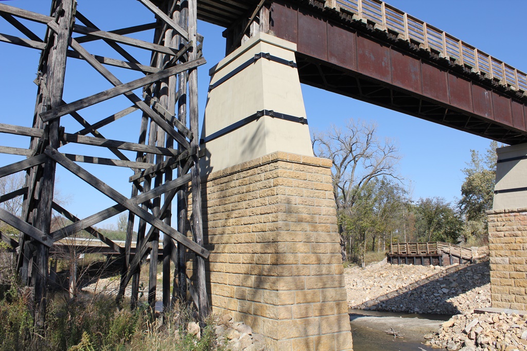
This massive deck girder bridge is the highlight of the Red Jacket Trail.
Located between Rapidan and Skyline, the first bridge at this location was a deck truss and trestle bridge, set onto stone piers.
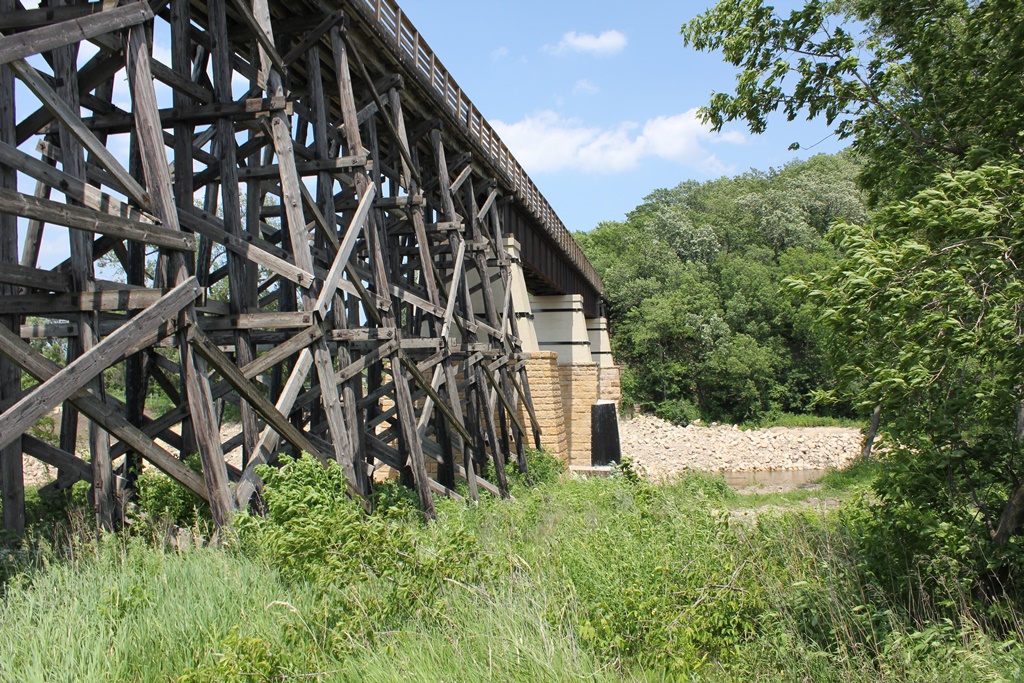
In 1901, the old bridge would be upgraded by the current bridge, which added concrete risers to the stone piers, and replaced the trusses with deck girders. At a later date, an additional deck girder was added to cross a road (now County Road 1).
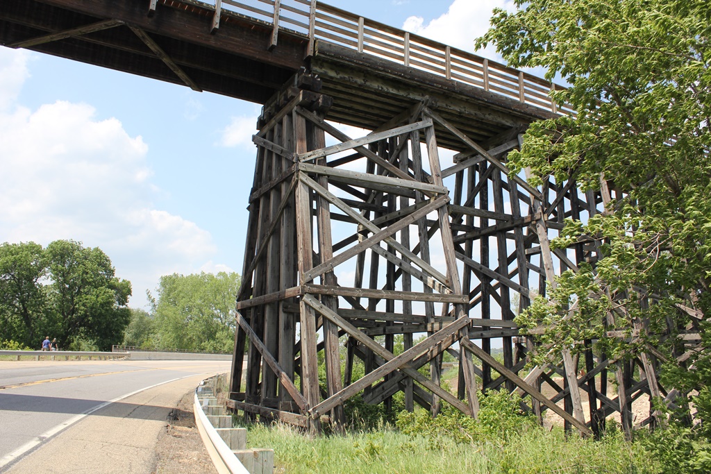
Currently, the bridge features a pair of deck girder spans, set onto stone and concrete piers. It is approached by wooden trestle on either side. When the trail was constructed, the original deck girder span was removed for unknown reasons, and replaced with the current bridge.
A failure of the south pier during a period of flooding in 2010 resulted in the south span being placed on the ground and the original pier demolished. It was replaced with a replica pier in 2011, and reopened.
Overall, the bridge appears to be in good condition. It is a landmark in the area, and a must see site in southern Minnesota.
The author has ranked the bridge as being moderately significant, due to the large scale design of the girders.
The photo above is an overview.